Torres del Paine in Patagonia
Three granite towers, horns of dark rock, turquoise lakes and a wind that never quite stops. Torres del Paine is one of the great walking parks of the world.
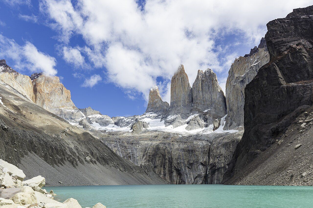
Torres del Paine National Park lies in Chilean Patagonia, near the southern tip of South America. Its centrepiece is the Paine massif, a cluster of granite peaks rising suddenly from the steppe, ringed by lakes in shades of milky turquoise and blue. Glaciers spill down from the great ice field to the west, guanacos graze the open slopes, and condors ride the wind above the ridges.
It is a park built for walking. A network of well-marked trails links lakes, valleys and viewpoints, and the most famous route, the W, threads past the best of them in a few days.
The towers
The park takes its name from three granite towers, the Torres, which rise side by side above a small glacial lake. Paine is thought to come from an old local word for blue, a reference to the colour of the lakes and the ice. The towers are best seen from the Base de las Torres viewpoint, at the end of a long day hike from the east side of the park.
The trail climbs up the Ascencio valley, through beech forest, and finishes with a steep scramble up a slope of boulders and loose moraine. The last hour is hard work, but the reward is the view of the towers rising straight out of a pale green lake. Many hikers start in the dark to see them at sunrise, when the rock can glow orange for a few minutes.
The Cuernos and the lakes
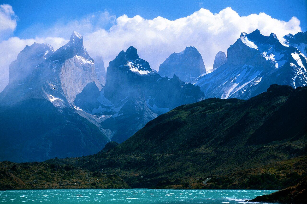
The other famous shape in the park is the Cuernos del Paine, the "horns", a row of peaks of pale granite capped with dark rock, like two layers of stone stacked on top of each other. They are best seen from the shores of Lago Pehoé and Lago Nordenskjöld, where the water turns a striking turquoise from fine rock flour carried down by the glaciers.
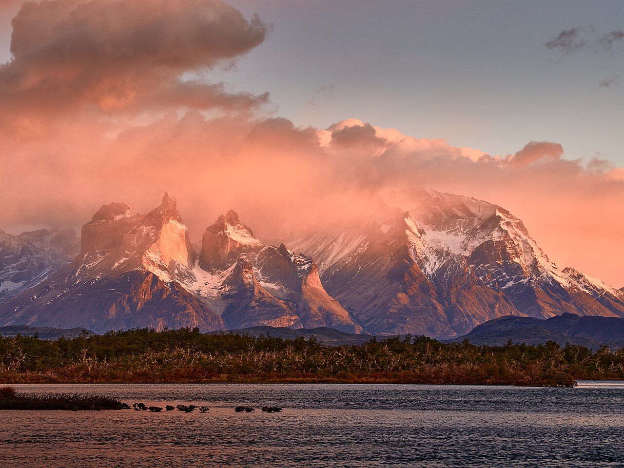
Light changes fast here. One moment the peaks are hidden in cloud, the next they are lit pink and gold. Sunrise and sunset are worth the effort, especially from the lake shores.
The W trek
The W is the best-known multi-day hike in the park. Its route, shaped roughly like the letter, links three of the main sights along the south side of the massif: the Base de las Torres in the east, the French Valley in the middle, and Grey Glacier in the west. Most people take four or five days, sleeping in refuges or at campsites along the way.
The French Valley climbs between the Cuernos and the bulk of Paine Grande, with hanging glaciers cracking and rumbling on the walls above you. In the west, the trail runs along Lago Grey to viewpoints over the glacier, a broad wall of blue ice ending in the lake, with icebergs floating below.
Also on the blog: Iceland's Ring Road
The longer O circuit loops right round the massif, including the wilder north side and the pass above Grey Glacier. It takes about a week or more and is a tougher undertaking, with some sections open only in the main season.
You do not need to hike for days to enjoy the park. Day walks, short trails to waterfalls and lake viewpoints, and drives along the park roads all show you the mountains.
Book refuges and campsites ahead
Overnight stays inside the park must be booked in advance. The refuges and campsites along the W and the O are run by a small number of operators, places are limited, and the busy months of December to February fill up many months ahead. Rangers check reservations along the trails, and you may be turned back without one.
Plan your route first, then book each night in order, since the timing of one stop decides the next. There is also a park entry fee, and the rules for registering and paying change from time to time.
The wind
Wind is the defining feature of Patagonia. It blows mostly from the west, off the ice field, and in summer gusts can be strong enough to knock you off your feet. Hikers sometimes have to crouch and wait on exposed ridges and lake shores until a gust passes.
Bring a windproof shell, a hat that will not blow away, and gloves even in summer. Weather changes fast, and a warm, sunny morning can turn into cold rain or sleet by the afternoon. Keep your pack balanced, hold onto loose gear, and be careful near cliff edges and on boulder fields.
The wind also makes fire a very real danger. Large fires have burned parts of the park in the past, and the rules on stoves and fires are strict. Cook only where it is allowed, and never light an open fire.
Getting there and when to go
The gateway town is Puerto Natales, a few hours to the south by road. Buses run from the town to the park entrances in the hiking season, and from there catamarans and shuttles link some of the trailheads. Punta Arenas, further south, is the other main town in the region.
The main season runs from about November to March, the southern summer, with long days and the most services. Spring and autumn are quieter and can be beautiful, with autumn colours on the beech trees in April. Winter brings short days, snow and limited facilities.
If you love long walks through big country, the cliffs of the Nā Pali coast offer another trail that needs permits and planning, and the black beaches of Iceland's Ring Road show a different side of wind and weather.
Trip notes
- Best time: Southern summer, December to February
- Months: November to March
- Getting there: Bus from Puerto Natales to the park
- Pack: Windproof shell, warm layers, sturdy boots, sunscreen, gloves