The Nā Pali coast of Kauaʻi
Green cliffs folded like curtains drop straight into the Pacific along Kauaʻi's north-west shore. No road crosses this coast, so you see it on foot, from the sea or from above.
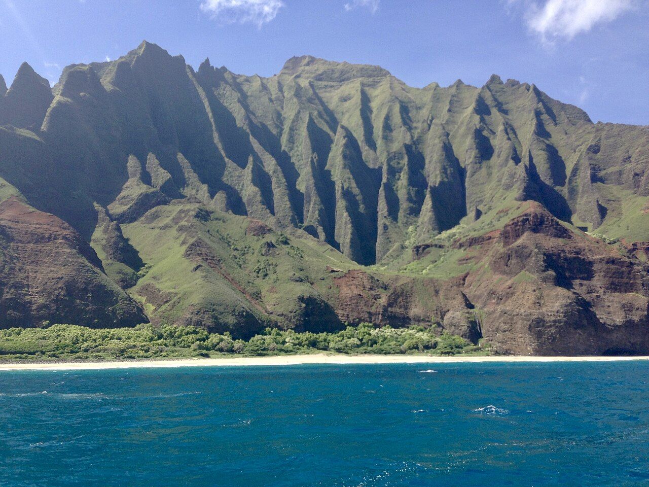
The Nā Pali coast runs for about seventeen miles along the north-west side of Kauaʻi, the oldest of the main Hawaiian islands. Here the land ends in sharp, fluted ridges that rise thousands of feet from the ocean, cut by deep valleys and laced with waterfalls after rain. Na pali means "the cliffs" in Hawaiian, and there is no better name for it.
No road runs along this coast. The highway on the north shore stops at one end, the road on the west side stops at the other, and in between there is only the sea, the cliffs and one famous trail. That is what keeps the place wild, and it shapes how you plan your visit.
The cliffs and valleys
The cliffs are the worn remains of an old volcano, carved over millions of years by rain, streams and waves. The result is a series of ridges so steep and narrow that they look like folds of green cloth. Between them lie hanging valleys and broad ones, such as Kalalau, where Hawaiians once farmed taro on terraces whose stone walls can still be found under the forest.
Most of the coast is protected as the Nā Pali Coast State Wilderness Park, along with neighbouring state parks at either end. Treat the valleys with respect. Many hold old sites of cultural importance, and some areas are closed to protect them.
The Kalalau Trail
The Kalalau Trail is the only land route along the coast. It starts at Kēʻē Beach at the end of the road in Hāʻena and runs about eleven miles to Kalalau Beach, crossing streams and climbing in and out of valleys on a narrow, often muddy path. Parts of it sit on steep slopes with long drops to the sea.
The first two miles, from the trailhead to Hanakāpīʻai Beach, make a popular day hike. From the beach, a side trail climbs inland about two more miles to Hanakāpīʻai Falls, a tall ribbon of water dropping into a pool. Even this short section is rough and slippery, so allow most of a day for the round trip to the falls.
The trail beyond Hanakāpīʻai is a serious hike, usually done over two days or more with camping along the way. It is only for fit, experienced hikers who are comfortable on exposed ground.
Also on the blog: Iceland's Ring Road
Permits and reservations
Access to this coast is carefully managed, and you need to plan well ahead:
- Day visits to Hāʻena State Park, where the trail begins, need an advance reservation for most visitors, either for parking or for a shuttle. Spaces are limited and go quickly.
- Hiking beyond Hanakāpīʻai, or camping anywhere along the trail, needs a camping permit from the state parks service. These permits are limited in number and often sell out months ahead.
- Rangers check permits, and the rules, numbers and booking windows change from time to time.
Do not try to hike without the right permit.
Staying safe on foot
Streams along the Kalalau Trail can rise very fast after heavy rain, sometimes when it is not even raining where you stand. Never try to cross a stream in flood. Wait for the water to drop, even if that means waiting for hours or turning back.
The beaches here are beautiful and dangerous. Hanakāpīʻai in particular has strong currents and powerful surf, and people have drowned there. Admire the water from the sand. Watch the weather, start early, wear proper shoes and carry enough water, food and rain gear for a longer day than you plan.
Seeing the coast from the sea
Many visitors see Nā Pali from the water, and it is arguably the finest way to appreciate the scale of the cliffs. Boat trips leave from harbours on the south and west sides of the island and run up the coast, past sea caves, waterfalls and long beaches that are hard or impossible to reach on foot.
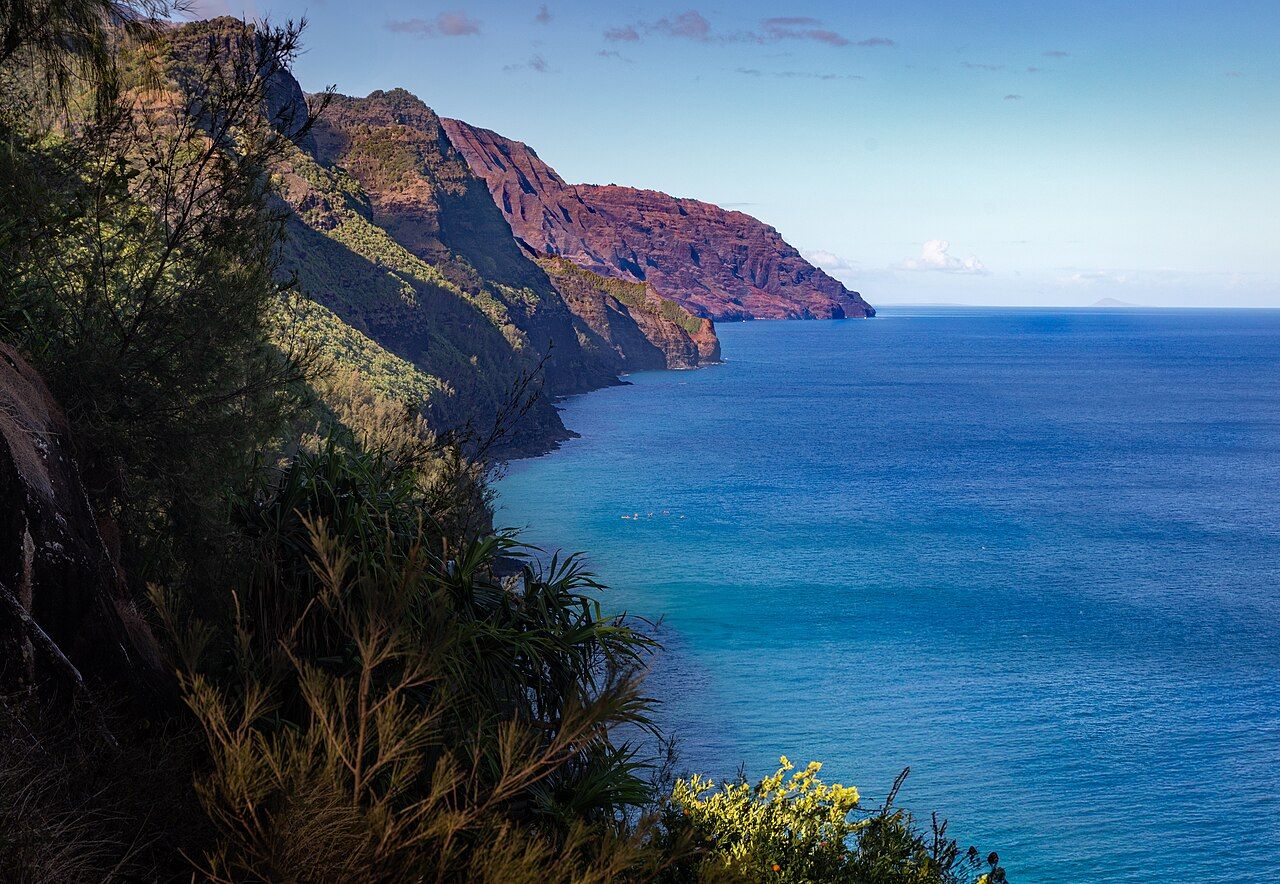
In summer, when the sea is usually calmer, experienced paddlers also travel the coast by kayak on guided trips. In winter, big swells from the north often make the sea rough, and trips are shorter or cancelled. Spinner dolphins are common, and in winter you may see humpback whales offshore. Bring motion sickness tablets if you are prone to it, and expect to get wet.
The view from the lookouts
If you would rather keep your feet dry, drive up to the lookouts at the top of the cliffs. The road climbs from the west side of the island past Waimea Canyon into Kōkeʻe State Park, ending at about 4,000 feet. Near the end of the road, the Kalalau Lookout looks straight down into the Kalalau Valley, with its knife-edge ridges falling away to the sea far below.
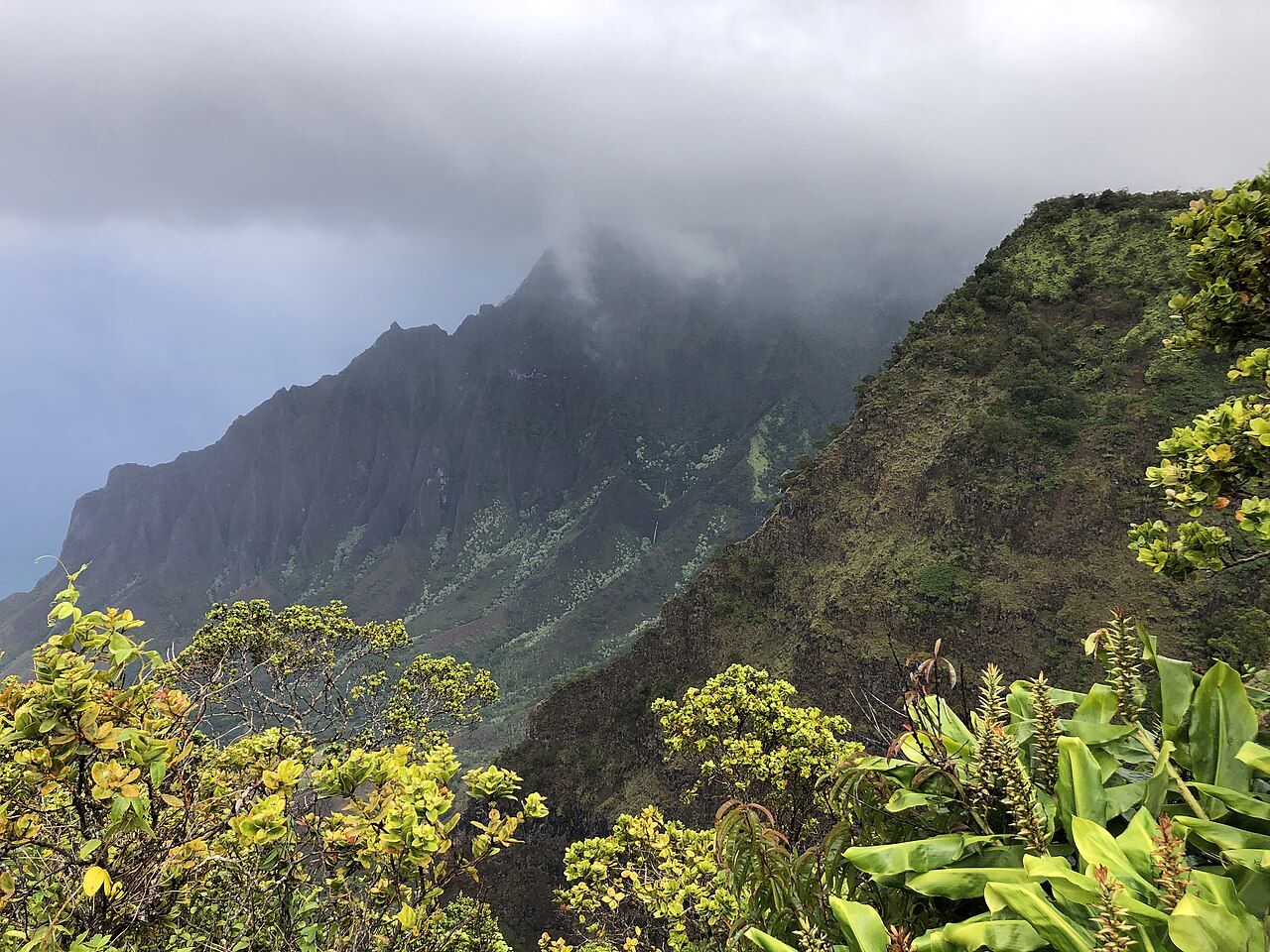
A little further on, the Puʻu o Kila Lookout gives a slightly different angle. Clouds often fill the valley later in the day, so come early, and if the view is hidden, wait a while. The mist can clear in minutes. Bring a warm layer, because it is noticeably cooler up here than on the coast.
Waimea Canyon, on the way up, deserves its own stops: a long red and green gorge with its own set of viewpoints.
The good months at Kauaʻi
Summer, roughly May to September, usually brings calmer seas and drier trails, which makes it the best season for boat trips, kayaking and the Kalalau Trail. Winter brings more rain and big surf on this side of the island, though the lookouts are worth a visit year-round.
If dramatic coastlines move you, the black sand and sea stacks of Iceland's Ring Road show a very different volcanic shore, and the granite towers of Torres del Paine offer another long walk through wild country.
Trip notes
- Best time: Calm summer mornings
- Months: May to September
- Getting there: Drive to Hāʻena or up to Kōkeʻe
- Pack: Sturdy shoes, rain jacket, water, sun protection, snacks