Iceland's Ring Road
One road loops right around Iceland, past waterfalls, glaciers, black beaches and lonely farms. Driving it is easy most days, as long as you respect the weather and the sea.
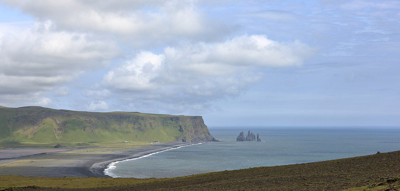
Route 1, the Ring Road, is the main highway around Iceland. It runs for about 1,300 kilometres in a loop around the island, linking Reykjavík with the farms, fishing towns and wild country of the south, east and north. Most of it is paved, two-lane road, and much of it is quiet for long stretches. The scenery changes almost by the hour: waterfalls, lava fields, black beaches, glacier tongues, fjords and wide green valleys.
The road itself is not difficult. What makes Iceland demanding is the weather, which can change fast and hard. Plan with that in mind and the drive is a joy.
How long to allow
You could drive the whole loop in a few long days, but you would see little beyond the windscreen. A week is a sensible minimum, and ten days or more lets you stop, walk and wait out bad weather without stress. Many people drive the loop anticlockwise, starting with the south coast, where the best-known sights are closest to Reykjavík.
Distances between towns can be long, especially in the east and the north-east. Fill up when you can rather than when you must, and know where the next fuel stop is before you leave a town.
Waterfalls of the south coast
The south coast is the busiest part of the Ring Road and the richest in waterfalls. Seljalandsfoss drops from an old sea cliff in a single slim stream, and a path loops behind the falling water so you can see it from the back. Expect to get soaked, and expect the path behind it to be closed when it is icy.
A short drive east, Skógafoss is wider and more powerful, a curtain of water falling about sixty metres onto a flat gravel plain. A long staircase climbs beside it to a viewing platform at the top, and a trail continues upstream past more falls. On sunny days, rainbows hang in the spray.
Further around the loop, in the north, Goðafoss sits right beside the road between Mývatn and Akureyri, a broad horseshoe of water that is easy to visit on the way. Dettifoss, one of the most powerful waterfalls in Europe, is a short detour off the Ring Road in the north-east.
Black beaches and sea stacks
Near the village of Vík, the beach at Reynisfjara is one of the most striking places in Iceland. Black volcanic sand stretches along the shore, a cliff of basalt columns rises like organ pipes at one end, and offshore stand the Reynisdrangar, tall dark sea stacks rising out of the surf.
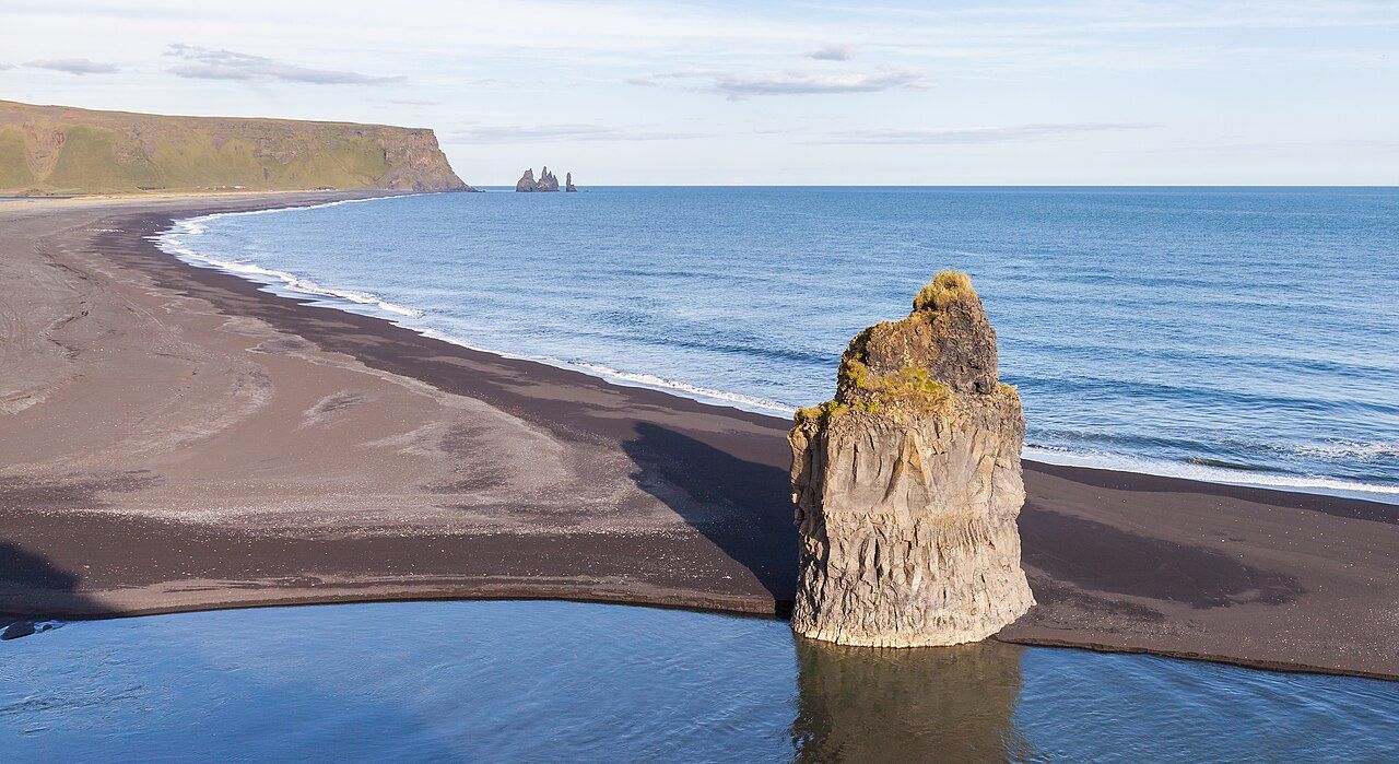
This beach is also genuinely dangerous. Sneaker waves surge far up the sand without warning, much further than the waves before them, and the undertow is very strong. People have been swept out and drowned here. Stay well back from the water's edge, never turn your back on the sea, keep children close, and follow the warning signs and any closures.
Also on the blog: The Nā Pali coast of Kauaʻi
For a view of the whole scene from above, drive to the headland of Dyrhólaey, just west of Vík. From its cliffs you look east along the beach to the sea stacks, and you can see the great rock arch that gives the headland its name.
Glaciers and lagoons
East of Vík the road crosses wide black plains of sand and gravel washed out from under the glaciers. Vatnajökull, the largest ice cap in Iceland, sends long tongues of ice down towards the road. At Jökulsárlón, icebergs break off a glacier and drift across a lagoon before floating out to sea, and across the road chunks of ice wash up on the black sand, glittering in the light.
Do not walk onto glaciers without a qualified guide and proper gear. Crevasses and melting ice make them dangerous, however solid they look.
Weather and road safety
Iceland's weather deserves respect at any time of year. Check the official road and weather forecasts every morning, and again before any long stretch. A few habits keep you safe:
- Wind: strong gusts are common. Hold the car door firmly when you open it, since the wind can tear it off its hinges, and slow down on exposed stretches.
- Gravel: where the pavement ends, slow down before you reach the gravel and keep to the middle until you meet oncoming traffic.
- One-lane bridges: several remain on the Ring Road. The car that reaches the bridge first has the right of way.
- Stopping: never stop on the road to take photos. Pull into a proper lay-by.
- Sheep: they roam freely in summer and wander onto the road.
- Off-road driving: it is illegal and badly damages fragile ground.
In winter, add snow, ice, very short days and road closures. If you drive the Ring Road between October and April, choose a suitable car, learn how to drive on ice, and be ready to change your plans when a storm comes in.
Farms and open country
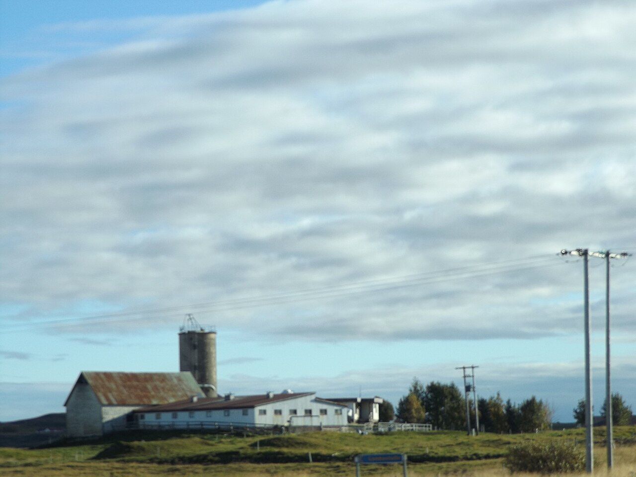
Between the famous stops, much of the Ring Road passes through farmland: isolated farmhouses, red-roofed barns, horses in the fields and long views over moss and lava. These quiet stretches are part of the charm of the drive, so leave time to take them slowly.
In June and July, the sun barely sets and you can drive and walk late into the evening. In winter, daylight shrinks to a few hours, but the northern lights become possible on clear, dark nights.
If long drives and wild coast are your idea of a holiday, the windswept trails of Torres del Paine make a natural next adventure, and the cliffs of the Nā Pali coast show another island shaped by volcanoes and the sea.
Trip notes
- Best time: Long summer days, June to August
- Months: June to August
- Getting there: Drive east from Reykjavík on Route 1
- Pack: Waterproofs, warm layers, hat, gloves, snacks, offline map